Fox Glacier to Haast, February 21-22, 2025
It rained buckets last night, but by 9AM, we had sunny skies with a few clouds. The air was fresh and clear, and after breakfast, we returned to the Tohu Whenua viewpoint that opened in 2024. It provides direct views of Fox Glacier, Mt. Tasman (11,473 ft/3,497m), and Mt. Cook (12,218 ft/3,724m). From this viewpoint Mt. Tasman is the most prominent peak. I expect we'll see more impressive views of Mt. Cook from Lake Tekapo.
When I planned this trip from half a world away, I was concerned about driving long distances over winding mountain roadways. But I also wanted to make sure we had time to enjoy this UNESCO World Heritage region of outstanding natural beauty. That's why I reserved two nights in Fox Glacier and two nights in Haast.
On our drive out of Fox Glacier, we took our time to take some pictures and videos at roadside turnouts. One of the best was Knights Point. Within minutes after our view and bathroom break there, we were stopped by a road crew while they did some pretty spectacular cliff clean up. We spent about 25 minutes watching harnessed road crew members break boulders away from a cliff face overlooking the World Heritage Highway.
I also included a video of Ship Creek Beach on the Tasman Sea. And you won't believe the video Marie took as we crossed the Haast River. This bridge is famous for being the longest single-lane bridge in the southern hemisphere. After the crossing, we pulled into the Department of Conservation Visitor Centre as planned, and it's a good thing we did, because our hotel was about 100 meters away.
Before leaving Fox Glacier I entered the address of The Heartland Hotel into Google Maps (my usual routine), but didn't bother opening the app, knowing we had at least a 1hr30min drive to Haast. If I hadn't planned on stopping at the visitor centre, we could have easily driven beyond the turn off to our hotel and driven on to Haast Township only to find our hotel was about a 100 meters from where we were standing inside the visitor centre.
That was the good news. The disappointing news was that the Blue Pools Walk is closed, because the two suspension bridges leading to these azure blue pools are being refurbished. When I made our hotel reservation for two nights here six months ago there wasn't any way of knowing this walk would be closed. The ranger at the Dept. of Conservation Visitor Centre told us that if we felt comfortable fording the Haast River and continuing on along the trail, we could make it to the pools. She did warn, however, that the river could be tricky but that crossing it was possible. We decided to forgo this walk.
So here are the pictures from our leisurely drive today beginning with some last looks from Fox Glacier.
 |
| Taken from our Sunset Motel room in Fox Glacier. |
 |
| Fox Glacier and Mt. Tasman from Tohu Whenua viewpoint. |
 |
| Another close up of Mt. Tasman. |
 |
| Fox Glacier from Tohu Whenua viewpoint. |
 |
| Mt. Tasman Tohu Whenua viewpoint. |
The longest single-lane bridge in the Southern Hemisphere.
Haast, February 22, 2025
The South Westland is part of the UNESCO World Heritage area of outstanding natural beauty. I had hopes of walking to the Blue Pools, but as I said above the walk is closed so today we will take in a different section of the World Heritage area and drive to the fishing village at Jackson Bay.
This sheltered bay is known for having more seals and penguins than people and "is one of only two known areas in South Westland regularly used as a nursery area by the rare Hector's dolphin females and their calves." (https://www.newzealand.com/nz/feature/jackson-bay-fishing-village) The Jackson Bay settlement (1875-79) failed for several reasons—there wasn't any flat land to grow crops and resupplying the settlement was expensive and unreliable, because the only way to do so was via ships.
 |
| This colorful fellow was outside our room early this morning. |
 |
| The road to Jackson Bay is gorgeous and isolated. |
 |
| We probably saw 8 cars in 48 km. |
Jackson Bay/Okahu is the end of the road.
 |
| The Jackson Bay pier is still used by commercial fishers. |

 |
| I asked this fisherman and he fishes lobster. |
 |
| Locals take advantage of the boat launch at the "end of the road". |
Panorama of Jackson Bay's sheltered harbor.
We couldn't believe she took a swim in the icy water.
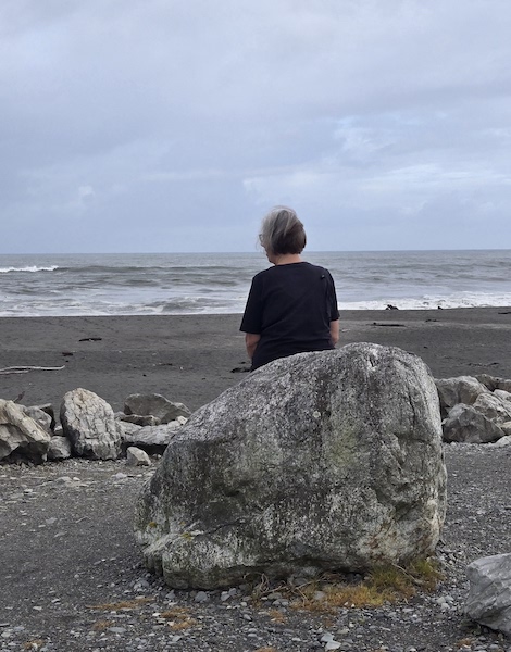
Yesterday the wind roiled the Tasman Sea but today it's calm.
 |
That's us all right! We're all about quality.
|
 |
| Didn't ask about the venison. |
Tomorrow we'll cross Haast Pass to Wanaka. We'll take our time and enjoy the outstanding beauty of the UNESCO World Heritage Highway.